 |
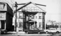
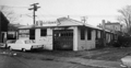
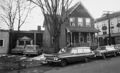
167 and 163 Washington St.
This photo was taken prior to the leveling of the block for the Hearthstone Plaza and the leveling of the entire area then known as The Marsh. The business of the Brookline Bulk Candy was deemed by the Brookline Redevelopment Authority to be neighborhood-specific and was relocated across the street at 216 Washington St. By contrast, the Ames Supply Co., partially viewed on the left, was not given an option to relocated nearby.
[Source: Brookline Preservation Department]
|
 |
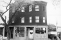
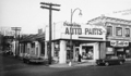
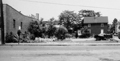
171 Washington St.
The tracks to the D subway line lie immediately to the left. The building anchored the northwest corner of the area then known as The Marsh that would soon be completely leveled in an urban renewal project. Ames Supply Co. was one of thirteen businesses forced out by the Brookline Redevelopment Authority, being deemed not essential to Village Life and therefore not eligible for local relocation on redeveloped land.
[Source: Brookline Preservation Department]
|
 |
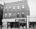
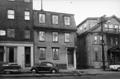
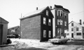
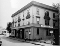
202 -222 Washington St.
All buildings still stand.
[Source: Brookline Preservation Department]
|
 |
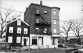
645/647 Brookline Ave.
This photo was taken prior to the leveling of the entire area then known as The Marsh.
[Source: Brookline Preservation Department]
|
 |
682/684 Brookline Ave.
Looking east. Gulf service station on the corner of Lower Washington St. is on the right. This photo was taken prior to the leveling of the entire area then known as The Marsh.
[Source: Brookline Preservation Department]
|
 |
Emerald St.
9 Emerald St. is on the left, sideview of 657 Brookline Ave. is on the right. This photo was taken prior to the leveling of the entire area then known as The Marsh.
[Source: Brookline Preservation Department]
|
 |
647, 651, 657 Brookline Ave.
Looking from right to left. This photo was taken prior to the leveling of the entire area then known as The Marsh.
[Source: Brookline Preservation Department]
|
 |
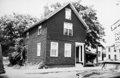
65 Pearl St.
This photo was taken prior to the leveling of the entire area then known as The Marsh.
[Source: Brookline Preservation Department]
|
 |
81, 84, 85 Pearl St.
The northeast extension of Pearl St. is viewed looking west several houses in from Brookline Ave. 85 Pearl St. is on the left followed by 81 Pearl St. On the corner and a building of Brookline Oil Co. across the street at 84 Pearl St. This photo was taken prior to the leveling of the entire area then known as The Marsh.
[Source: Brookline Preservation Department]
|
 |
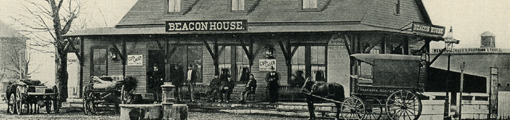
91 Washington St.
Pearl St. looking north to the left.
[Source: Brookline Preservation Department]
|
 |
68 Pearl St.
This photo was taken prior to the leveling of the entire area then known as The Marsh.
[Source: Brookline Preservation Department]
|
 |
21 Pearl St.
Looking south at 21 Pearl St. On the right, where Pearl St. turns left toward Lower Washington St., is the building at 10-14 Pearl St. This photo was taken prior to the leveling of the entire area then known as The Marsh.
[Source: Brookline Preservation Department]
|
 |
68 Pearl St.
On the left is a partial view of a newer brick building at 50 Pearl St. In the middle rear is 68 Pearl St. located on the former northern extension of Pearl St. In the middle foreground are vacant lots where several apartment buildings recently stood. This photo was taken prior to the leveling of the entire area then known as The Marsh.
[Source: Brookline Preservation Department]
|
 |
10 and 14 Pearl St.
Looking toward Lower Washington St. with the rear of the White Castle restaurant visible in the distance. On the right are 10 and 14 Pearl St. William Francis Conant, the long-time owner of The Brookline Print, had recently been living upstairs in this building with his third wife, Adelaide Huestis Conant, when he died in 1959. This photo was taken prior to the leveling of the entire area then known as The Marsh.
[Source: Brookline Preservation Department]
|
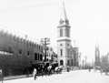 |
Harvard St.
Looking north on Harvard St. from Harvard Sq. On the left is the rear of the Rhodes supermarket which opened at the beginning of 1906, the house at 20 Harvard St. and the Baptist Church.
[Source: Brookline Preservation Department]
|
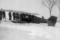 |
Crash Landing of Plane, Larz Anderson Estate, January 30, 1928
A mail plane flying from New York to Boston lost power after experiencing a broken fuel line and was force to crash land on the estate. The only occupant was the pilot who was unharmed.
[Source: Joel Shield]
|
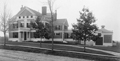 |
150 Fisher Ave.
[Source: Brookline Preservation Department]
|
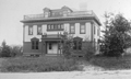 |
70 Hyslop Rd.
[Source: Brookline Preservation Department]
|
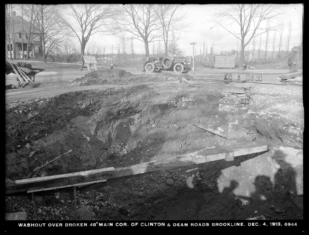 |
Clinton and Dean Rds.
Looking northwest toward Beacon St. 233 Clinton Rd. is on the left. In the early morning hours of December 5, 1913 (the date imprinted on the photo is inaccurate), a large water main burst here flooding the neighborhood and damaging homes.
In the center of the photo is the car of fire chief George H. Johnson. It is a Knox Model R Chiefs Car that was delivered to the town in August, 1909. It could seat the chief and his driver up front, two firefighters in the back, and carried light equipment like a lantern, axe, and extinguisher. It was capable of traveling at speeds up to 50 mph and was a dramatic change from the horses that were used just a few years earlier.
[Source: Digital Commonwealth]
|
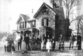 |
Frederick Sears Extended Family, 24 Cottage Farm Rd.
This presumably the extended family of Frederick Sears. In 1849, David Sears laid out the Cottage Farm neighborhood and built houses for himself, his four daughters, and this house for his son, Frederick, which still stands.
[Source: Brookline Preservation Department]
|