 |
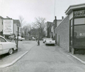
Village Lane
Looking from Walnut St.
[Source: Brookline Preservation Department]
|
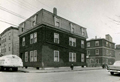 |
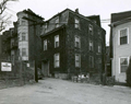
Walter Ave., Corner with Morss Ave.
Looking from Morss Ave. On the far left is 24 Walter Ave. On the corner is 26 Walter Ave. On the right is 33 Villa Lane.
[Source: Brookline Preservation Department]
|
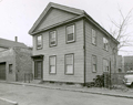 |
19 Villa Lane
[Source: Brookline Preservation Department]
|
 |
Village Lane
left to right: #13, #9. #7 (partial view)
[Source: Brookline Preservation Department]
|
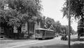 |
Trolley, Brookline Ave.
Looking northeast. At the immediate left is 615 Brookline Ave. at the corner of Pearl St. Robert Winthrop School is on the other side of Pearl St.
|
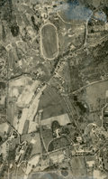 |
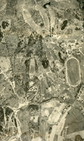
Aerial Photo, The Country Club Area, 1930
Newton St. runs left to right. Partial view of the Larz Anderson estate on the right.
[Source: Digital Commonwealth]
|
 |
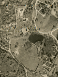
Aerial Photo, The Country Club Area, 1930
Newton St. runs left to right.
[Source: Digital Commonwealth]
|
 |
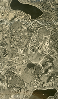
Aerial Photo, Sargent's Pond Area, 1930
Cottage St. on the left.
[Source: Digital Commonwealth]
|
 |
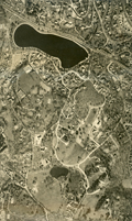
Aerial Photo, Warren St. Area, 1930
[Source: Digital Commonwealth]
|
 |
Aerial Photo, Warren St. Area, 1930
[Source: Digital Commonwealth]
|
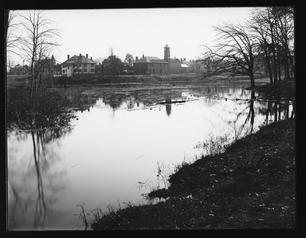 |
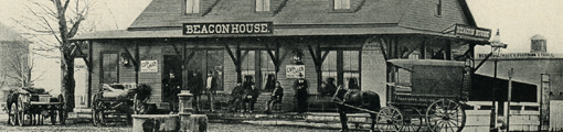
Devotion St. Engine House
Looking south from the Babcock Pond waters. Babcock Pond was part of a creek system flowing south from Commonwealth Ave. and was filled in soon after this photo was taken. From left to right:
- Carriage house of 63 Babcock St. (speculative)
- 63 Babcock St. (speculative)
- The duplex house at 9/11 Devotion St., still standing
- Devotion fire house on the north side of Devotion St.
- Rear of houses and carriage houses on Babcock St.
[Source: Digital Commonwealth]
|
 |
The Finnerty Family (Edward, John, Ellen, Kit, Mary T. ) and Nellie Walsh, c. 1897
Edward Finnerty, not pictured, was the son of an Irish immigrant. By 1885 he and his family were living in the area of Boylston St. and Hammond St., an area with a number of other Irish families. He was an ice-man working for the Jamaica Pond Ice Company in the days before refrigerators when ice blocks were delivered to houses. In 1892, the Finnerty family moved to this house at 1198 Boylston St. where they remained in various iterations until 1924.
In the photo are the following:
- Catherine (Kit) J. Finnerty (b. 1892)
- Helen Francis (Ellen) Finnerty (b. 1889)
- Edward J. Finnerty (b. 1883), he later worked as a driver for an ice company
- John Joseph Finnerty (b. 1879)
- Mary T. Finnerty (b. 1877)
- Nellie Walsh, details unknown
Contributor: Mary Ellen Carney
[Source: University of Massachusetts Boston]
|
 |
Lyceum Hall Demolition, Late 1937
The Brookline Theater, a movie theater, is under construction and the first show will occur on January 9, 1938. Awaiting demolition are Mullaney's Tobacco Store (111 Washington St.), O'Reilly's Lunch (109 Washington St.), and upstairs, the Lyceum Hall (107 Washington St.).
[Source: Brookline Preservation Department]
|
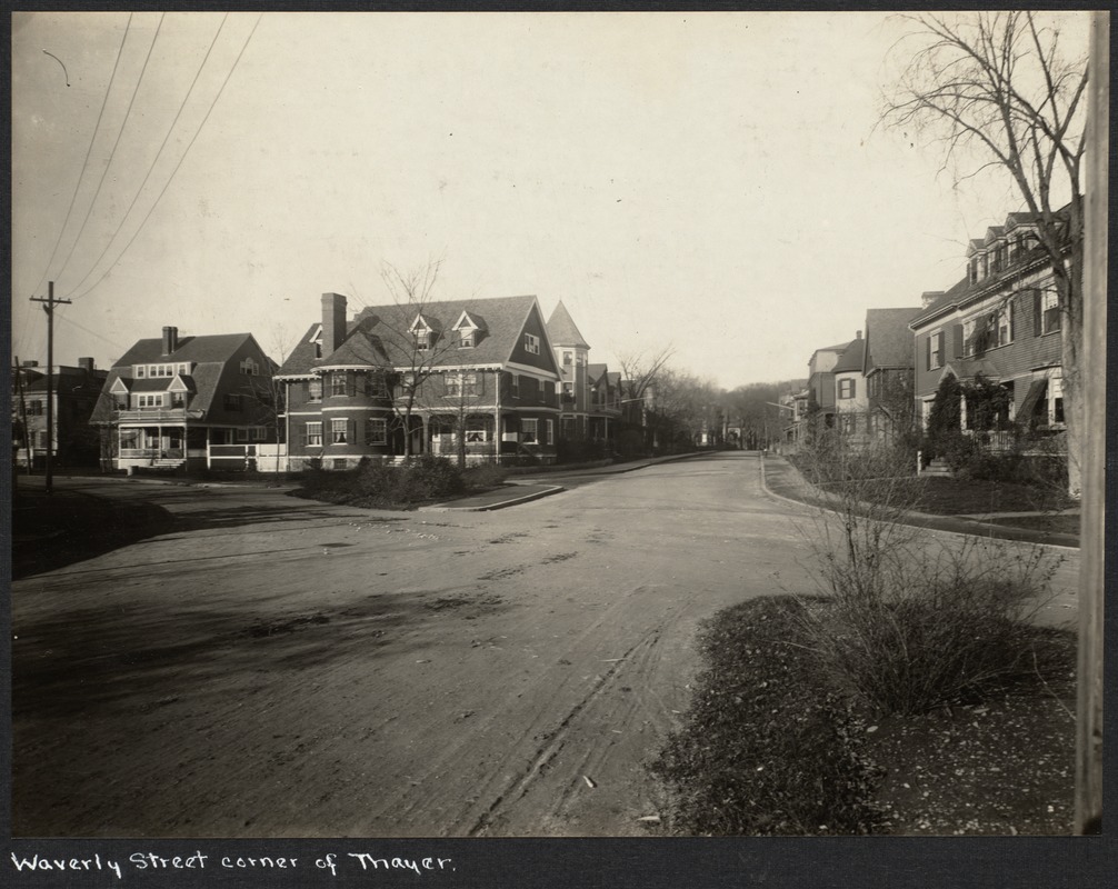 |
Waverly St.
Looking northwest on Waverly St. On the left are #28 and #34 Emerson St. across from Emerson Park. On the corner at the right is 25 Waverly St.
[Source: Digital Commonwealth]
|
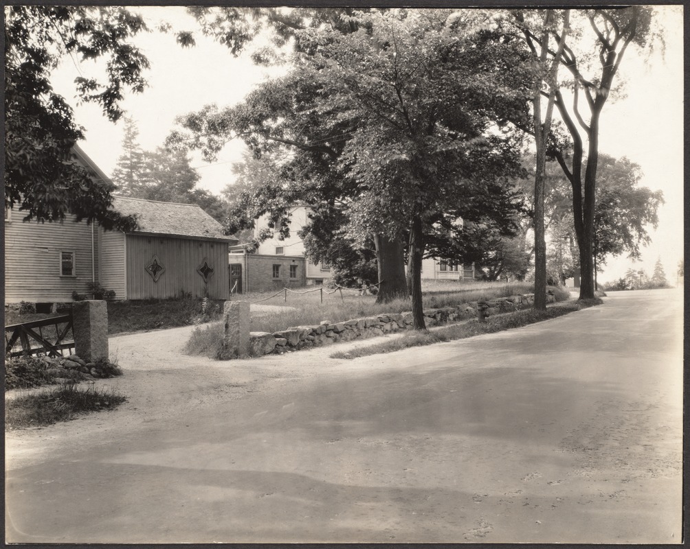 |
Grove St.
This location is speculatively identified as Grove St. just southwest of the intersection with South St. Note the children behind the large tree.
[Source: Digital Commonwealth]
|
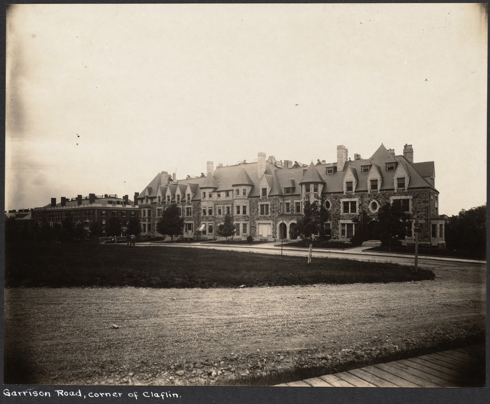 |
Garrison Rd.
Standing on Claflin Rd. looking at the north side of Garrison Rd. The buildings were constructed circa 1891-1892 and all are still standing.
[Source: Digital Commonwealth]
|
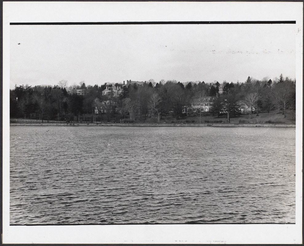 |
Fisher Hill, South Side
Looking north across Boylston St. In the foreground on the left is 617 Boylston with 71 Leicester St. behind it. On the right is 575 Boylston St., with 80 Leicester St. behind it. At the top of the hill is 120 Seaver St., the former estate of Mary Baker Eddy. All are still standing.
[Source: Digital Commonwealth]
|
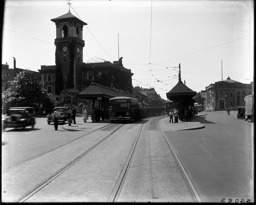 |
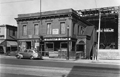
Lower Washington St., mid 1930s
Looking west on lower Washington St. toward the start of Boylston St. In the center of the photo, situated across High St. from the fire station, the Ford sign of T. C. Baker, a Ford dealership at 2 Boylston St., is visible. This is one of three photos taken of this block.
[Source: Historic New England]
|
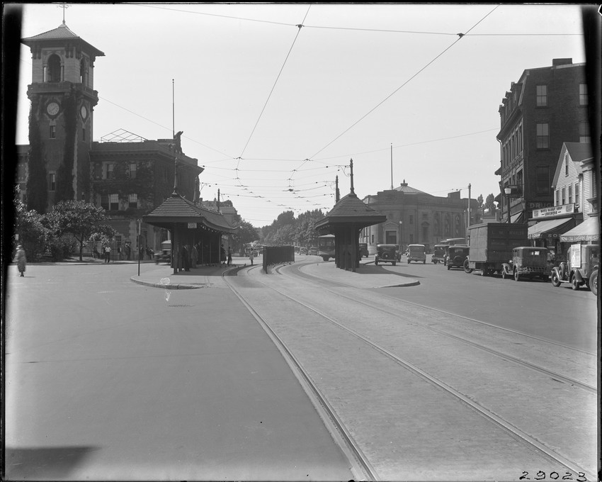 |
Lower Washington St., mid 1930s
This is one of three photos taken of this block. Looking west toward the start of Boylston St. From left to right:
- The fire house, still standing
- The Brookline Savings Bank, building still standing
- The tall brick building known as the Sagamore which housed Burns Drug Co. at 127 Washington St., visible on the right side
- The Davis Candy Shop at 121 Washington St.
- The van of Leslie W. Whalen, a Brookline mover
- A car advertising Brick Bradford, a science-fiction comic strip in Bostons Daily Record newspaper
- Partial view of The Village Spa at 115 Washington St., run by the Rozantes family who lived upstairs above the store.
[Source: Historic New England]
|
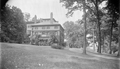 |
Blake Estate, Aspinwall Hill, 450 Washington St.
The estate comprised a large amount of land on the hill above todays high school. The house itself was located approximately at the southeast corner of todays Blake Rd. and Gardner Rd. It was owned by two generations of the Blake family and was originally purchased from Lewis Tappan. It was torn down in 1941 and the land developed as todays Blake Park.
[Source: Digital Commonwealth]
|